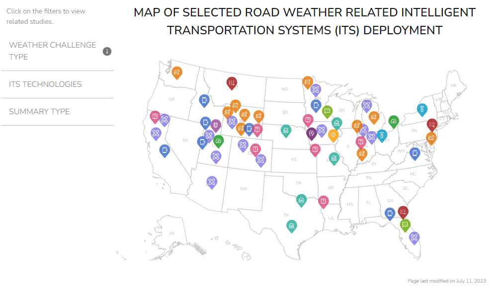
Map of Selected Road Weather ITS Deployments
This interactive map shows selected deployments of different road weather-related ITS technologies across the United States over the last 10+ years.
This visualization was developed using publicly available evaluation and research studies from the Benefits, Costs, and Lessons Learned Databases, the USDOT National Transportation Library, State Departments of Transportation, the Transportation Research Board, University Transportation Centers, and other published sources.
Tips for Using the Visualization: Hover your mouse over the points on the map as they appear (based on your selection on the left side panel) to learn more information and find links to the source documents.
Date posted: August, 2023
Map of Selected Road Weather Related Intelligent Transportation Systems (ITS) Deployment
Click on the filters to view related studies.
Weather Challenge Type
ITS Technologies
Summary Type
